| Passage Creek | |
|---|---|
 Passage Creek in early spring | |
| Location | |
| Country | United States |
| State | Virginia |
| Counties | Shenandoah, Warren, Page |
| Physical characteristics | |
| Source | |
| • location | West of Luray, Page County |
| • coordinates | 38°39′51″N 78°35′45″W / 38.66417°N 78.59583°W[1] |
| Mouth | North Fork Shenandoah River |
• location | East of Strasburg, Warren County |
• coordinates | 38°58′36″N 78°16′12″W / 38.97667°N 78.27000°W[1] |
| Length | 38.5 mi (62.0 km)[2] |
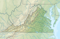
Passage Creek is a 38.5-mile-long (62.0 km)[2] tributary stream of the North Fork Shenandoah River in Fort Valley, Virginia. For most of its length it flows through a rural valley between the two spine-like ridges of Massanutten Mountain, then exits the valley by cutting a narrow gorge through the northeast end of the mountain.
- ^ a b "Passage Creek". Geographic Names Information System. United States Geological Survey, United States Department of the Interior. Retrieved December 10, 2016.
- ^ a b U.S. Geological Survey. National Hydrography Dataset high-resolution flowline data. The National Map, accessed August 15, 2011

