| Peak Mountain | |
|---|---|
 Peak Mountain, from Tynecastle (Linville Gap) | |
| Highest point | |
| Elevation | 4,921 ft (1,500 m)[1] |
| Coordinates | 36°07′51″N 81°50′01″W / 36.13083°N 81.83361°W[1] |
| Geography | |
| Location | Avery County, North Carolina, U.S. |
| Parent range | Blue Ridge Mountains |
| Topo map | USGS Valle Crucis |
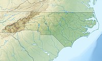
Peak Mountain is a mountain in the North Carolina High Country, near the town of Seven Devils. It is known by several other names such as Tynecastle Peak, Invershiel Peak and Dunvegan Peak.[2] It is wholly in the Pisgah National Forest. Its elevation reaches 4,921 feet (1,500 m).
The headwaters of the Elk River begins from the Northwestern slopes of the mountain; along the Southwestern slopes, it shares with Sugar Mountain and Flattop Mountain as the headwaters of the Linville River; along the Southeastern slopes, it shares with Grandfather Mountain as the headwaters of the Watauga River.
- ^ a b "Peak Mountain". Geographic Names Information System. United States Geological Survey, United States Department of the Interior. Retrieved 2009-12-29.
- ^ Staff Report. "Blue Ridge Conservancy purchases Peak Mountain acreage". Watauga Democrat. Retrieved 2022-03-29.
