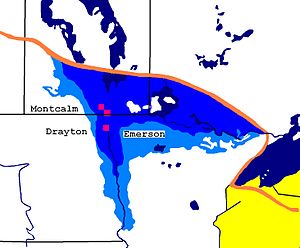
The Pembina Escarpment is a scarp that runs from South Dakota to Manitoba, and forms the western wall of the Red River Valley. The height of the escarpment above the river valley is 300–400 feet (91–122 m).[1]
- ^ Ashworth, Allan; Bluemle, John. "The Pembina Escarpment". North Dakota Geological Survey. Archived from the original on 2009-06-19.