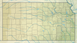
| Perry Lake | |
|---|---|
 Perry Dam | |
 | |
| Location | Jefferson County, Kansas |
| Coordinates | 39°10′38″N 95°27′06″W / 39.17722°N 95.45167°W |
| Type | Reservoir |
| Primary inflows | Delaware River |
| Primary outflows | Delaware River |
| Catchment area | 1,117 sq mi (2,890 km2) |
| Basin countries | United States |
| Managing agency | U.S. Army Corps of Engineers |
| Built | 1964 |
| First flooded | January 15, 1969 |
| Max. length | 20 mi (32 km) |
| Surface area | 11,146 acres (45.11 km2) |
| Max. depth | 43 ft (13 m)[1] |
| Water volume | Full: 209,513 acre⋅ft (258,430,000 m3)[2] Current (Jan. 2016): 190,200 acre⋅ft (234,600,000 m3)[3] |
| Shore length1 | 160 mi (260 km) |
| Surface elevation | Full: 892 ft (272 m)[2] Current (Jan. 2016): 891 ft (272 m)[3] |
| Settlements | Perry, Newman, Ozawkie, Thompsonville, Lakeside Village |
| References | [4] |
| 1 Shore length is not a well-defined measure. | |

Perry Lake is a US Army Corps of Engineers operated reservoir in northeast Kansas. Its primary purposes are flood control, water reserve for nearby areas and regional recreation. The lake is approximately 11,150 acres (45 km2) in size, with over 160 miles (260 km) of shoreline.[5] Perry Lake's full multi-purpose pool elevation is 891.5 feet (271.7 m) above sea level. Perry Lake is located about 40 miles (64 km) west of Kansas City, just northwest of Lawrence, Kansas. Its close proximity to Kansas City, Lawrence, and the state capitol, Topeka, make it a very popular destination, with the nickname "Paradise on the Plains".[6]
- ^ "Perry Reservoir Fishing Information". Kansas Department of Wildlife, Parks and Tourism. Retrieved 2016-01-22.
- ^ a b Cite error: The named reference
Volumewas invoked but never defined (see the help page). - ^ a b "USGS 06890898 Perry Lake near Perry, KS". U.S. Geological Survey. Retrieved 2016-01-22.
- ^ "Perry Lake". Geographic Names Information System. United States Geological Survey, United States Department of the Interior. Retrieved 2016-01-22.
- ^ "Welcome to Perry Lake". U.S. Army Corps of Engineers-Kansas City District website. 2012. Retrieved 14 October 2012.
- ^ "Slough Creek, KS". Recreation.gov. 2012. Retrieved 16 October 2012.

