| Peterhead Bay | |
|---|---|
 Peterhead Bay coast showing the town in the distance. | |
| Location | Buchan, Aberdeenshire Scotland |
| Coordinates | 57°29′57.9660″N 1°46′57.2376″W / 57.499435000°N 1.782566000°W |
| Ocean/sea sources | North Sea |
| Basin countries | Scotland |
| Max. length | 6.43738 km (4.00000 mi) |
| Max. width | 4.82803 km (3.00000 mi) |
| Average depth | 20 metres (66 ft) |
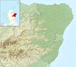
Peterhead Bay is a large remote industrial tidal 120° facing coastal embayment, located next to the planned community, commercial fishing and ship building town of Peterhead in the Presbytery of Deer, Buchan, Aberdeenshire, and is in the most easternmost point in mainland Scotland.[1] The bay lies to the south of the town, forming a large natural harbour. It was enclosed by breakwaters, to turn the natural harbour[2] into a marina and port, that is now owned by the Port of Peterhead.[3] It was here, on 25 December 1715, that the old pretender, James Francis Edward Stuart, landed and resided at a house at the south end of Longate, owned by Mr James, and being visited by his friends, including George Keith, the Earl Marischal.[4]
- ^ Microsoft; Nokia. "Peterhead Bay" (Map). Bing Maps. Microsoft. Retrieved 4 April 2017.
- ^ "Peterhead Bay". The Gazetteer for Scotland. School of GeoSciences, University of Edinburgh and The Royal Scottish Geographical Society. Retrieved 7 April 2017.
- ^ "Peterhead Bay Marina". Peterhead Port Authority. Peterhead Port Authority. Retrieved 7 April 2017.
- ^ Peter Buchan (1819). Annals of Peterhead, from its foundation. p. 10.
