This article needs additional citations for verification. (September 2021) |
Petropavl
| |
|---|---|
 | |
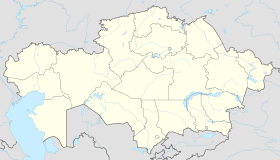
| Coordinates: 54°53′N 69°10′E / 54.883°N 69.167°E | |
| Country | Kazakhstan |
| Region | North Kazakhstan Region |
| Founded | 1752 |
| City Status | 1807 |
| Government | |
| • Akim (mayor) | Serik Mukhamediev[1] |
| Area | |
| • Total | 221.6 km2 (85.6 sq mi) |
| Elevation | 140 m (460 ft) |
| Population (2009) | |
| • Total | 201,446 |
| • Density | 910/km2 (2,400/sq mi) |
| Time zone | UTC+5 (Time in Kazakhstan) |
| Postal code | 150001 - 150013 |
| Area code | +7 7152 |
| Vehicle registration | T, 15 |
| Website | petropavl |
Petropavl (Kazakh: Петропавл (); Russian: Петропавловск, romanized: Petropavlovsk) is a city on the Ishim River in northern Kazakhstan close to the border with Russia. It is the capital of the North Kazakhstan Region.[2] Population: 218,956.[3] The city is also known colloquially in Kazakh as Qyzyljar (Kazakh: Қызылжар, lit. 'Red cliff').
Petropavl is about 185 km (115 mi) from Kökşetau, 428 km (266 mi) northwest of the national capital Astana along the A1, 261 km (162 mi) from Omsk.
- ^ "Нового акима назначили в Петропавловске". kazpravda.kz (in Russian). July 1, 2023.
- ^ "Город Петропавловск". stat.kz. Archived from the original on July 1, 2007. Retrieved April 22, 2018.
- ^ "Chislennost naselenia Kazakhstana 2019".

