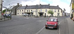
Pettigo
Paiteagó | |
|---|---|
Village | |
 Village centre | |
| Coordinates: 54°32′56″N 7°49′52″W / 54.549°N 7.831°W | |
| Jurisdictions | Republic of Ireland and Northern Ireland |
| Province | Ulster |
| County | County Donegal, County Fermanagh |
| Population (2022) | |
| • Urban | 557 |
| Time zone | UTC+0 (WET) |
| • Summer (DST) | UTC-1 (IST (WEST)) |
| Irish Grid Reference | H105669 |
Pettigo, also spelt Pettigoe (/ˈpɛtɪɡoʊ/ PET-ig-oh; Irish: Paiteagó[1] [ˈpˠatʲəɡoː]), is a small village and townland on the border of County Donegal, Republic of Ireland, and County Fermanagh, Northern Ireland. It is bisected by the Termon River which is part of the border between the Republic of Ireland and Northern Ireland.
The portion of the village in County Fermanagh is officially called Tullyhommon but is locally known as 'High Street' because of its hillside position overlooking the remainder of the village. The rest of the village in the Republic includes Main Street, Mill Street and Station Street, all of which meet in The Diamond at the centre of the village. There are also two relatively modern housing estates on the northern outskirts, Termon Villas and St. Patrick's Terrace, along with new developments such as Mill Grove.
Until the late 1700s, the area was known as An Tearmann, meaning 'a place of sanctuary'. The modern Irish (Paiteagó) and English (Pettigo) names derive from the Latin protectio (protection), a translation of the Irish An Tearmann.
- ^ "Paiteagó/Pettigo". Placenames Database of Ireland (logainm.ie). Retrieved 7 May 2022.
