39°34′00″N 22°00′44″E / 39.56679°N 22.01213°E

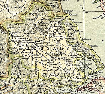
Pharcadon or Pharkadon (Ancient Greek: Φαρκαδών or Φαρκηδών) was a city and polis (city-state)[1] of Histiaeotis in ancient Thessaly, situated to the left of the Peneius, between Pelinnaeum and Atrax.[2][3]
In 200 BCE, during the Second Macedonian War, Athamanian troops commanded by Amynander of Athamania and troops of the Aetolian League, allies of the Romans, established their camps around the city of Pharcadon while they plundered the Thessalian plain. They were attacked by troops of Philip V of Macedon, who put them to flight.[4]
The site of Pharcadon is on a hill near the village of Klokoto in the municipality of Farkadona, which was renamed to reflect its association with Pharcadon.[5][6]
- ^ Mogens Herman Hansen & Thomas Heine Nielsen (2004). "Thessaly and Adjacent Regions". An inventory of archaic and classical poleis. New York: Oxford University Press. pp. 701-702. ISBN 0-19-814099-1.
- ^ Strabo. Geographica. Vol. 9.5.17. Page numbers refer to those of Isaac Casaubon's edition.
- ^ Stephanus of Byzantium. Ethnica. Vol. s.v.
- ^ Livy. Ab urbe condita Libri [History of Rome]. Vol. 31.41-42.
- ^ Richard Talbert, ed. (2000). Barrington Atlas of the Greek and Roman World. Princeton University Press. p. 55, and directory notes accompanying. ISBN 978-0-691-03169-9.
- ^ Lund University. Digital Atlas of the Roman Empire.