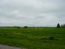
The Pickering Airport Lands are parcels of lands owned by the Government of Canada located in York Region and Durham Region in the Greater Toronto Area of Ontario. The lands, totaling approximately 18,600 acres (7,500 hectares) and located approximately 56 kilometres (35 miles) east of Downtown Toronto, were expropriated in 1972 by the federal government intending for a second international airport to serve the city of Toronto, its metropolitan area, and the surrounding Golden Horseshoe region.[1] Since then, the federal government has leased the lands to private tenants and allocated more than half to form the Rouge National Urban Park.[1]
Plans for an airport were developed during the late 1960s and early 1970s. The 1972 announcement affected properties in Pickering, Uxbridge, and Markham townships in York and Durham Regions. Residents were forced to leave as demolitions of houses and barns began. Preliminary airport construction activity was halted in 1975 when the provincial partner in the enterprise, the Government of Ontario, declared it would not build the roads or sewers needed to service the site. Despite later attempts by the federal government to revive the project, construction activities never resumed, and no operator was selected. There has been local opposition to an airport from the day of the original announcement.
Since the shelving of the project in 1975, the federal government has commissioned a number of studies to assess future aviation needs in southern Ontario. The most recent study was announced in April 2023. The potential future airport site currently measures approximately 3,521 hectares (8,700 acres). The site continues to be leased to private tenants for residential, commercial, and agricultural use.
- ^ a b Green, Kiernan (6 May 2023). "Pickering airport opponents hope the proposal will be abandoned after 50 years". thestar.com. Retrieved 6 May 2023.