Piedmont Triad | |
|---|---|
| Nickname(s): The Triad, PT, The 336 | |
 | |
| Country | |
| State | |
| Largest city | Greensboro |
| Counties | Alamance Caswell Davidson Davie Forsyth Guilford Montgomery Randolph Rockingham Stokes Surry Yadkin |
| Area | |
| • Land | 15,420 km2 (5,954 sq mi) |
| Population | |
| • Total | 1,705,315 |
| GDP | |
| • MSA | $89.968 billion (2022) |
| Time zone | UTC-5 (EST) |
| • Summer (DST) | UTC-4 (EDT) |
| Area codes | 336, 443 |
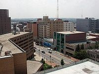
The Piedmont Triad (or simply the Triad) is a metropolitan region in the north-central part of the U.S. state of North Carolina anchored by three cities: Greensboro, Winston-Salem, and High Point. This close group of cities lies in the Piedmont geographical region of the United States and forms the basis of the Greensboro–Winston-Salem–High Point, NC Combined Statistical Area (CSA). As of 2012, the Piedmont Triad has an estimated population of 1,611,243 making it the 33rd largest combined statistical area in the United States.[3]
The metropolitan area is connected by Interstates 40, 85, 73, and 74 and is served by the Piedmont Triad International Airport. Long known as one of the primary manufacturing and transportation hubs of the southeastern United States, the Triad is also an important educational, healthcare, and cultural region and occupies a prominent place in the history of the American Civil Rights Movement.[4]
The Piedmont Triad is sometimes confused with the Research Triangle, an adjacent urbanized region of North Carolina that includes the cities of Raleigh, Durham and the town of Chapel Hill, among others. Both of them are part of the Piedmont Crescent, a heavily urbanized region of the state that includes the city of Charlotte.
- ^ "Total Gross Domestic Product for Greensboro-High Point, NC (MSA)". Federal Reserve Economic Data. Federal Reserve Bank of St. Louis.
- ^ "Total Gross Domestic Product for Winston-Salem, NC (MSA)". Federal Reserve Economic Data. Federal Reserve Bank of St. Louis.
- ^ "Population Estimates 2012 Combined Statistical Areas: April 1, 2010 to July 1, 2012". U.S. Census Bureau. Archived from the original on March 17, 2013. Retrieved 2013-03-14.
- ^ "Greensboro Sit-In". HISTORY. Retrieved 2020-04-10.


