Pine, Arizona | |
|---|---|
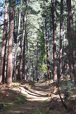
 Trail up Pine Canyon, in the Tonto National Forest | |
 Location in Gila County and the state of Arizona | |
| Coordinates: 34°23′4″N 111°27′18″W / 34.38444°N 111.45500°W | |
| Country | United States |
| State | Arizona |
| County | Gila |
| Area | |
• Total | 32.42 sq mi (83.97 km2) |
| • Land | 32.41 sq mi (83.95 km2) |
| • Water | 0.01 sq mi (0.02 km2) |
| Elevation | 5,369 ft (1,636 m) |
| Population (2020) | |
• Total | 1,953 |
| • Density | 60.25/sq mi (23.26/km2) |
| Time zone | UTC-7 (MST (no DST)) |
| ZIP code | 85544 |
| Area code | 928 |
| FIPS code | 04-55700 |
| GNIS feature ID | 32916 |
Pine is an unincorporated community and census-designated place (CDP) in Gila County, Arizona, United States. The population was 1,953 at the 2020 census.[2] Pine was established by four Mormon families in 1879.
Pine and the adjacent community of Strawberry are rapidly growing vacation and retirement centers in north-central Arizona, below the Mogollon Rim. Pine's elevation is 5,369 feet (1,636 m), and the Pine post office was established in 1884.[3]
- ^ "2020 U.S. Gazetteer Files". United States Census Bureau. Retrieved October 29, 2021.
- ^ "Geographic Identifiers: 2010 Demographic Profile Data (G001): Pine CDP, Arizona". U.S. Census Bureau, American Factfinder. Retrieved November 2, 2016.[dead link]
- ^ Pine-Strawberry community profile Archived February 16, 2015, at the Wayback Machine