Pine Knot, Kentucky | |
|---|---|
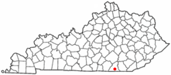
 Location in Kentucky | |
| Coordinates: 36°39′53″N 84°26′22″W / 36.66472°N 84.43944°W | |
| Country | United States |
| State | Kentucky |
| County | McCreary |
| Area | |
| • Total | 6.47 sq mi (16.75 km2) |
| • Land | 6.40 sq mi (16.59 km2) |
| • Water | 0.06 sq mi (0.16 km2) |
| Elevation | 1,411 ft (430 m) |
| Population | |
| • Total | 1,380 |
| • Density | 215.49/sq mi (83.19/km2) |
| Time zone | UTC-5 (Eastern (EST)) |
| • Summer (DST) | UTC-4 (EDT) |
| ZIP code | 42635 |
| Area code | 606 |
| FIPS code | 21-61122 |
| GNIS feature ID | 2403414[2] |
Pine Knot is an unincorporated community and census-designated place (CDP) in McCreary County, Kentucky, United States. The population was 1,380 at the 2020 census,[3] down from 1,621 in 2010.
- ^ "2022 U.S. Gazetteer Files: Kentucky". United States Census Bureau. Retrieved May 9, 2023.
- ^ a b U.S. Geological Survey Geographic Names Information System: Pine Knot, Kentucky
- ^ a b "P1. Race – Pine Knot CDP, Kentucky: 2020 DEC Redistricting Data (PL 94-171)". U.S. Census Bureau. Retrieved May 9, 2023.