Pinotepa Nacional | |
|---|---|
Municipality and town | |
 Pinotepa Nacional | |
 Major cities of Oaxaca | |
| Coordinates: 16°20′17″N 98°03′01″W / 16.33806°N 98.05028°W | |
| Country | |
| State | Oaxaca |
| Area | |
| • Municipality | 804.5 km2 (310.6 sq mi) |
| • Town | 11.86 km2 (4.58 sq mi) |
| Population (2020 census)[1] | |
| • Municipality | 55,840 |
| • Density | 69/km2 (180/sq mi) |
| • Town | 33,726 |
| • Town density | 2,800/km2 (7,400/sq mi) |
| Time zone | UTC-6 (Central (US Central)) |
| • Summer (DST) | UTC-5 (Central) |
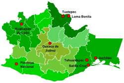
Pinotepa Nacional (formally: Santiago Pinotepa Nacional; in Ñu'savi, Ñuu Ñoko, which means Twenty-House Town) is a city and seat of the municipality of the same name, in the Mexican state of Oaxaca. It is located in the Jamiltepec District in the west of the Costa Region. The name Pinotepa means "toward the crumbling hill" in Náhuatl.
- ^ Citypopulation.de Population of Santiago Pinotepa Nacional municipality with localities

