| Pitt Lake | |
|---|---|
 | |
| Location | British Columbia |
| Coordinates | 49°25′N 122°33′W / 49.417°N 122.550°W[1] |
| Type | Fjord lake and Tidal lake |
| Primary inflows | Pitt River |
| Primary outflows | Pitt River |
| Basin countries | Canada |
| Max. length | 24 km (15 mi) |
| Max. width | 4.5 km (2.8 mi) |
| Surface area | 53.5 km2 (20.7 sq mi) |
| Max. depth | 150 m (490 ft) |
| Surface elevation | 3 m (9.8 ft)[2] |
| Islands | Goose, Little Goose, Gosling |
| References | [1] |
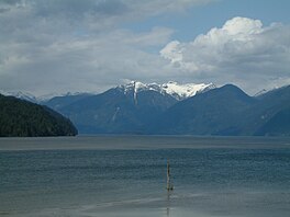
Pitt Lake is the second-largest lake in the Lower Mainland of British Columbia. About 53.5 km2 (20.7 sq mi) in area, it is about 25 km (16 mi) long and about 4.5 km (2.8 mi) wide at its widest. It is one of the world's relatively few tidal lakes, and among the largest. In Pitt Lake, there is on average a three-foot tide range; thus Pitt Lake is separated from sea level and tidal waters during most hours of each day during the 15 foot tide cycle of the Pitt River and Strait of Georgia estuary immediately downstream.[3] The lake's southern tip is 20 km (12 mi) upstream from The Pitt River confluence with the Fraser River and is 40 km (25 mi) east of Downtown Vancouver.
- ^ a b "Pitt Lake". BC Geographical Names.
- ^ Google Earth
- ^ Alard Ages and Anne Woollard (1976). "The Tides in the Fraser Estuary" (PDF). Institute of Ocean Sciences, Patricia Bay, Victoria, BC, Canada. pp. 7, 11. Retrieved 2016-12-16.
