Pixley, California | |
|---|---|
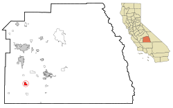
 Location in Tulare County and the state of California | |
| Coordinates: 35°58′13″N 119°17′27″W / 35.97028°N 119.29083°W | |
| Country | United States |
| State | California |
| County | Tulare |
| Named for | Frank M. Pixley |
| Area | |
| • Total | 3.114 sq mi (8.066 km2) |
| • Land | 3.114 sq mi (8.066 km2) |
| • Water | 0 sq mi (0 km2) 0% |
| Elevation | 272 ft (83 m) |
| Population | |
| • Total | 3,828 |
| • Density | 1,200/sq mi (470/km2) |
| Time zone | UTC-8 (Pacific (PST)) |
| • Summer (DST) | UTC-7 (PDT) |
| ZIP code | 93256 |
| Area code | 559 |
| FIPS code | 06-57512 |
| GNIS ID | 1652777 |
Pixley is a census-designated place (CDP) in Tulare County, California, United States. The population was 3,310 at the 2010 census, up from 2,586 at the 2000 census.
- ^ "2010 Census U.S. Gazetteer Files – Places – California". United States Census Bureau.
- ^ "US Census Bureau". www.census.gov. Retrieved August 23, 2024.
