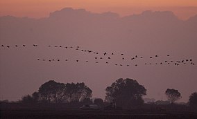
| Pixley National Wildlife Refuge | |
|---|---|
IUCN category IV (habitat/species management area) | |
 | |
Map of the United States | |
| Location | Tulare County, California, United States |
| Nearest city | Pixley, California |
| Coordinates | 35°55′02″N 119°21′44″W / 35.91717°N 119.36233°W[1] |
| Area | 6,939 acres (28.08 km2) |
| Established | 1959 |
| Governing body | U.S. Fish and Wildlife Service |
| Website | Pixley National Wildlife Refuge |
Pixley National Wildlife Refuge is located 35 miles (56 km) south of Tulare, California and 45 miles (72 km) north of Bakersfield in the San Joaquin Valley. The 6,939-acre (2,808 ha) nature refuge represents one of the few remaining examples of the grasslands, vernal pools, and playas that once bordered historic Tulare Lake, the largest lake west of the Great Lakes until the late 19th century.
