Polykastro
Πολύκαστρο | |
|---|---|
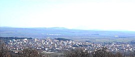
 General view | |
| Coordinates: 41°00′N 22°34′E / 41.000°N 22.567°E | |
| Country | Greece |
| Administrative region | Central Macedonia |
| Regional unit | Kilkis |
| Municipality | Paionia |
| Area | |
| • Municipal unit | 312.7 km2 (120.7 sq mi) |
| • Community | 45.8 km2 (17.7 sq mi) |
| Population (2021)[1] | |
| • Municipal unit | 11,338 |
| • Municipal unit density | 36/km2 (94/sq mi) |
| • Community | 6,609 |
| • Community density | 140/km2 (370/sq mi) |
| Time zone | UTC+2 (EET) |
| • Summer (DST) | UTC+3 (EEST) |
| Postal code | 612 00 |
| Vehicle registration | ΚΙ |
Polykastro (Greek: Πολύκαστρο, before 1928 Καρασούλι, Karasoúli;[2]) is a town and a former municipality in Kilkis regional unit of Central Macedonia, Greece. Since the 2011 local government reform it is part of the municipality Paionia, of which it is a municipal unit, and the seat. The municipal unit has an area of 312.717 km2, the municipal unit 45.775 km2.[3] The municipal unit of Polykastro has 12,000 inhabitants, and includes Polykastro and 23 villages. It is built near the Axios River, on the road and railway from Thessaloniki to Belgrade. It was formerly known as Karasuli (Turkish),[4][5] Mavrosuli[4] or Rugunovec (Macedonian and Bulgarian: Ругуновец).[5]
- ^ "Αποτελέσματα Απογραφής Πληθυσμού - Κατοικιών 2021, Μόνιμος Πληθυσμός κατά οικισμό" [Results of the 2021 Population - Housing Census, Permanent population by settlement] (in Greek). Hellenic Statistical Authority. 29 March 2024.
- ^ "Karasouli – Polykastron". Retrieved 2016-11-21. Pandektis: Name Changes of Settlements in Greece, compiled by the Institute for Neohellenic Research
- ^ "Population & housing census 2001 (incl. area and average elevation)" (PDF) (in Greek). National Statistical Service of Greece.
- ^ a b (in Greek) Dikaeos Vassiliadis, "History of Polykastro", Polykastro
- ^ a b Vasil Kanchov, Macedonia; Ethnography and Statistics, 1900

