Poquonock Bridge | |
|---|---|
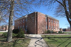
 Groton Town Hall | |
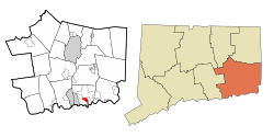
 Location in New London County, Connecticut | |
| Coordinates: 41°20′42″N 72°01′29″W / 41.34500°N 72.02472°W | |
| Country | United States |
| State | Connecticut |
| County | New London |
| Town | Groton |
| Area | |
| • Total | 1.4 sq mi (3.7 km2) |
| • Land | 1.4 sq mi (3.5 km2) |
| • Water | 0.077 sq mi (0.2 km2) |
| Elevation | 98 ft (30 m) |
| Population (2010) | |
| • Total | 1,727 |
| • Density | 1,200/sq mi (470/km2) |
| Time zone | UTC−5 (Eastern (EST)) |
| • Summer (DST) | UTC−4 (EDT) |
| ZIP code | 06340 |
| Area code | 860 |
| FIPS code | 09-61730 |
| GNIS feature ID | 2377852[1] |
Poquonock Bridge is a census-designated place (CDP) and village in the town of Groton in New London County, Connecticut, United States. The population was 1,686 at the 2020 census.[2]
The village is located just east of the head of the Poquonnock River near the intersection of U.S. Route 1 and Connecticut Route 117. The village was first settled in 1652–53 by James Morgan, James Avery, and Nehemiah Smith. The Groton Town Hall is located in the village.