This article needs additional citations for verification. (November 2019) |
| Port Shelter | |
|---|---|
| Inner Port Shelter, Outer Port Shelter | |
| 牛尾海 (Yue Chinese) | |
 View of Inner Port Shelter, Port Shelter and Outer Port Shelter from the nearby mountain. Sai Kung town centre can be seen at the left bottom. The right bottom is Hebe Haven | |
 Map of Xin'an County of 1866 (enlarged), showing the Port Shelter and the town Sai Kung | |
| Location | Sai Kung District, the New Territories, Hong Kong |
| Coordinates | 22°20′30″N 114°17′20″E / 22.3417°N 114.289°E |
| Type | Bay / harbour |
| Part of |
|
| Designation | water [pollution] control zone |
| Salinity | 32.7 (measured in 2002–03; 3 sample points)[1] |
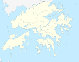
Port Shelter, known in Cantonese as Ngau Mei Hoi (Chinese: 牛尾海; Jyutping: ngau4 mei5 hoi2; Cantonese Yale: ngàuh méih hói), is a harbour south of Sai Kung Peninsula in Hong Kong. The water body connects to Inner Port Shelter (known in Cantonese as Sai Kung Hoi; Chinese: 西貢海; Jyutping: sai1 gung3 hoi2; Cantonese Yale: sāi gung hói), as well as Hebe Haven (白沙灣), Rocky Harbour (糧船灣海) and other water body. Outer Port Shelter, is situated at the mouth of the harbour.
