| Port of Tanjung Priok Pelabuhan Tanjung Priok | |
|---|---|
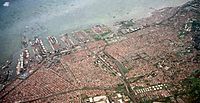
 Aerial view | |
 Click on the map for a fullscreen view | |
| Location | |
| Country | Indonesia |
| Location | Tanjung Priok, North Jakarta |
| Coordinates | 6°06′14″S 106°53′11″E / 6.104°S 106.8865°E |
| UN/LOCODE | ID TPP |
| Details | |
| Owned by | PT Pelabuhan Indonesia |
| Type of harbour | Coastal breakwater |
| Size of harbour | 604 ha (6.04 sq km) |
| Land area | 424 ha (4.24 sq km) |
| Size | 1,028 ha (10.28 sq km) |
| No. of berths | 76 |
| Statistics | |
| Annual container volume | 6.59 million TEU's (2013)[1] |
| Website www | |
The Port of Tanjung Priok (Indonesian: Pelabuhan Tanjung Priok) is the busiest and most advanced seaport in Indonesia,[2] handling more than 50% of Indonesia's trans-shipment cargo traffic. The port is located at Tanjung Priok, North Jakarta, and is operated by Indonesian state-owned PT Pelindo. The port has 20 terminals for accommodating general cargo, liquid bulk, dry bulk, containers, etc. It has specialised facilities catering to oil tankers, chemical-laden ships, metal scrap, and passengers.
The port loaded and unloaded 6.2 million, 6.92 million, and 7.8 million TEUs of cargo during 2016, 2017, and 2018, respectively, out of a total capacity of about 8 million TEUs.[3] Lloyd's One Hundred Ports 2019 ranked the container port as the 22nd busiest in the world.[4]
- ^ "Top 50 World Container Ports". www.worldshipping.org. Retrieved 16 June 2017.
- ^ "The 13,466-island problem". The Economist. Retrieved 16 June 2017.
- ^ "Indonesia inches closer to realizing port hub dream".
- ^ "One Hundred Ports 2019". Archived from the original on 26 August 2019. Retrieved 2 August 2019.