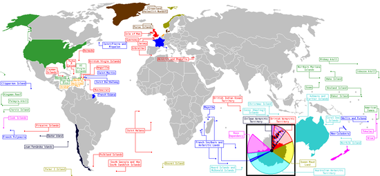
Portal:Maps/Maps/World

World 1

Portal:Maps/Maps/World/1

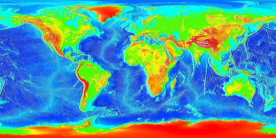
Global elevations
Global elevations
Credit: NGDC

World 2

Portal:Maps/Maps/World/2

Tectonic plates
Tectonic plates
Credit: Ævar Arnfjörð Bjarmason
Tectonic plates and movement of the earth.

World 3

Portal:Maps/Maps/World/3

Tropical cyclone affected areas
Credit: NSLE-Chacor
A map of tropical cyclone affected areas.

World 4

Portal:Maps/Maps/World/4

Countries with nuclear weapons
Credit: Mrnett1974

World 5

Portal:Maps/Maps/World/5

Topographic world map
Credit: David.Monniaux
Topographic map of the world showing both poles.

World 6

Portal:Maps/Maps/World/6

Metrication
Metrication
Credit: Astrokey44
World map showing metrication, color-coded by year of conversion.

World 7

Portal:Maps/Maps/World/7

Oceanic bathymetry
Oceanic bathymetry
Credit: NGDC

World 8

Portal:Maps/Maps/World/8

Military expenditure by country
Credit: Itemtried

World 9

Portal:Maps/Maps/World/9

Merchant marine by country
Credit: Astrokey44
Merchant marine by country, from CIA factbook.

World 10

Portal:Maps/Maps/World/10

Satellite imagery
Satellite imagery
Credit: NASA

World 11

Portal:Maps/Maps/World/11

Temperature anomalies
Credit: Dragons flight
Mean surface temperature anomalies during the period 1995 to 2004 with respect to the average temperatures from 1940 to 1980.

World 12

Portal:Maps/Maps/World/12

GDP in 2006
GDP in 2006
Credit: Bamse
Gross domestic product per capita in 2006.

World 13

Portal:Maps/Maps/World/13

Daylight at 1300
Daylight at 1300
Credit: Duesentrieb
World map showing daylight around 13:00 UTC, April 2nd, 2005.

World 14

Portal:Maps/Maps/World/14

Currency symbols of the world
Credit: 16@r
Currency symbols of the world, circa 2006.

World 15

Portal:Maps/Maps/World/15

Standard time zones
Standard time zones
Credit: CIA World Factbook, Trounce
Standard time zones of the world as of 2005.

World 16

Portal:Maps/Maps/World/16

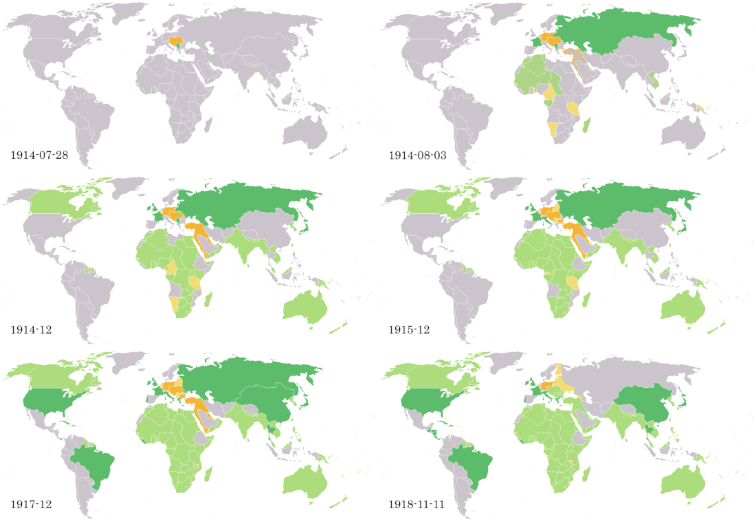
World War 1
World War 1
Credit: Astrokey44

World 17

Portal:Maps/Maps/World/17

Countries by population
Credit: Astrokey44

World 18

Portal:Maps/Maps/World/18

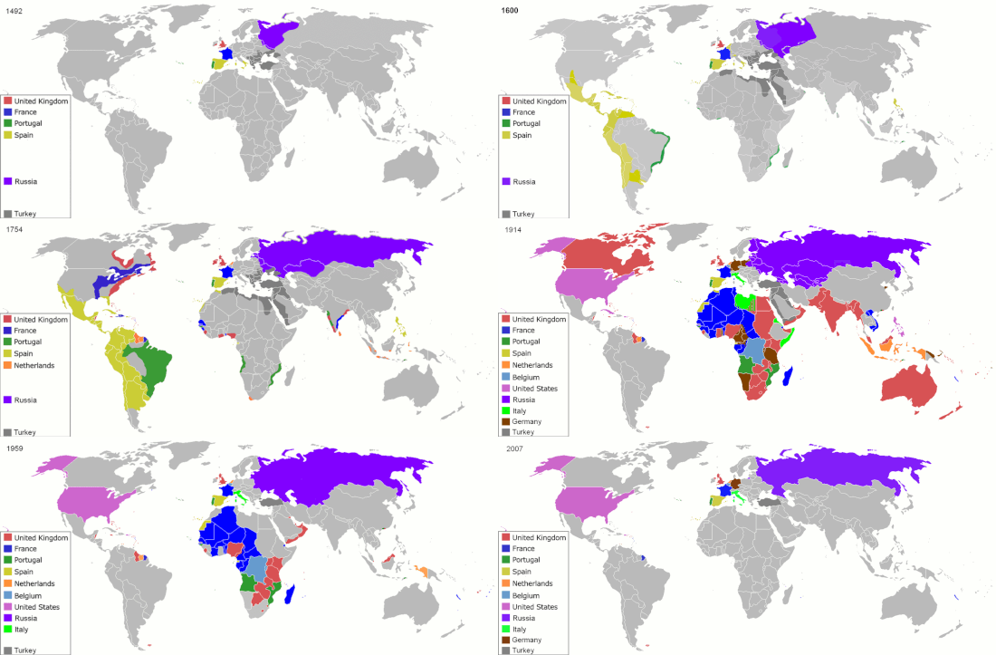
Colonialism since 1492
Credit: ArdadN
Map indicating the territories colonized by the European powers and the United States since 1492.

World 19

Portal:Maps/Maps/World/19

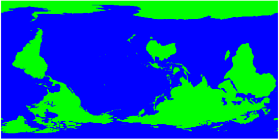
Reversed map
Reversed map
Credit: Henry Bottomley
A reversed map, challenging the tradition of north as "up".

World 20

Portal:Maps/Maps/World/20

Geologic provinces
Geologic provinces
Credit: USGS
World geologic provinces by origin.

World 21

Portal:Maps/Maps/World/21

HIV per country
HIV per country
Credit: Grcampbell
Prevalence of HIV among adults per country at the end of 2005.

World 22

Portal:Maps/Maps/World/22

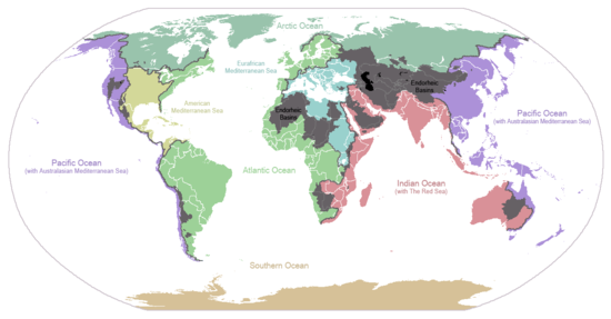
Drainage basins
Drainage basins
Credit: Citynoise
Drainage basins for the major oceans and seas; grey areas are endorheic basins.

World 23

Portal:Maps/Maps/World/23

Failed States Index
Failed States Index
Credit: Brianski
Failed states listed by the Failed State Index, 2005-2007.
World 24

Portal:Maps/Maps/World/24

Dependent territories
Credit: Dentren
Dependent territories and parent countries.