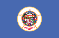
The Minnesota Portal Minnesota (/ˌmɪnəˈsoʊtə/ MIN-ə-SOH-tə) is a state in the Upper Midwestern region of the United States. It is bordered by the Canadian provinces of Manitoba and Ontario to the north and east and by the U.S. states of Wisconsin to the east, Iowa to the south, and North Dakota and South Dakota to the west. It is the 12th-largest U.S. state in area and the 22nd-most populous, with around 5.75 million residents. Minnesota is known as the "Land of 10,000 Lakes"; it has 14,420 bodies of fresh water covering at least ten acres each. Roughly a third of the state is forested. Much of the remainder is prairie and farmland. More than 60% of Minnesotans (about 3.8 million) live in the Minneapolis–Saint Paul metropolitan area, known as the "Twin Cities", which is Minnesota's main political, economic, and cultural hub and the 16th-largest metropolitan area in the U.S. Other minor metropolitan and micropolitan statistical areas include Duluth, Mankato, Moorhead, Rochester, and St. Cloud. Minnesota, which gets its name from the Dakota language, has been inhabited by various Native Americans since the Woodland period of the 11th century BCE. Between roughly 200 and 500 CE, two areas of the indigenous Hopewell tradition emerged: the Laurel complex in the north, and Trempealeau Hopewell in the Mississippi River Valley in the south. The Upper Mississippian culture, consisting of the Oneota people and other Siouan speakers, emerged around 1000 CE and lasted through the arrival of Europeans in the 17th century. French explorers and missionaries were the earliest Europeans to enter the region, encountering the Dakota, Ojibwe, and various Anishinaabe tribes. Much of what is now Minnesota formed part of the vast French holding of Louisiana, which the United States purchased in 1803. After several territorial reorganizations, the Minnesota Territory was admitted to the Union as the 32nd state in 1858. Minnesota's official motto, L'Étoile du Nord ("The Star of the North") is the only state motto in French. This phrase was adopted shortly after statehood and reflects both the state's early French explorers and its position as the northernmost state in the contiguous U.S. As part of the American frontier, Minnesota attracted settlers and homesteaders from across the country. Its growth was initially based on timber, agriculture, and railroad construction. Into the early 20th century, European immigrants arrived in significant numbers, particularly from Scandinavia, Germany, and Central Europe. Many were linked to the failed revolutions of 1848, which partly influenced the state's development as a center of labor and social activism. Minnesota's rapid industrialization and urbanization precipitated major social, economic, and political changes in the late 19th and early 20th centuries; the state was at the forefront of labor rights, women's suffrage, and political reform. Consequently, Minnesota is relatively unique among Midwestern states in being a reliable base for the Democratic Party, having voted for every Democratic presidential nominee since 1976, longer than any other U.S. state. (Full article...) Entries here consist of Good and Featured articles, which meet a core set of high editorial standards.
Minneopa State Park is a state park in the U.S. state of Minnesota. It was established in 1905 to preserve Minneopa Falls, a large waterfall for southern Minnesota, and was expanded in the 1960s to include the lower reaches of Minneopa Creek and a large tract of prairie. Minneopa is Minnesota's third oldest state park, after Itasca and Interstate. Two park resources are listed on the National Register of Historic Places: the 1862 Seppman Mill and a district of seven Rustic Style structures built by the Works Progress Administration in the late 1930s. The park is located almost entirely on the south side of the Minnesota River, three miles (4.8 km) west of Mankato. In 2015 the state reintroduced American bison to the park in a 330-acre (130 ha) fenced enclosure, through which visitors can drive in their vehicles. (Full article...) Selected article -The Minnesota Air National Guard's 148th Fighter Wing, equipped with F-16C Fighting Falcons, is based at Duluth Air National Guard Base, which is located on the grounds of the airport. Aircraft manufacturing company Cirrus is also based on the airport grounds, where it has its main manufacturing facilities and headquarters. (Full article...) General images -The following are images from various Minnesota-related articles on Wikipedia.
Did you know -
Related portalsTopicsLargest cities
CategoriesNew articlesThis list was generated from these rules. Questions and feedback are always welcome! The search is being run daily with the most recent ~14 days of results. Note: Some articles may not be relevant to this project.
Rules | Match log | Results page (for watching) | Last updated: 2024-11-17 20:53 (UTC) Note: The list display can now be customized by each user. See List display personalization for details.
WikiProjectsTasks
Associated WikimediaThe following Wikimedia Foundation sister projects provide more on this subject:
Sources
Discover Wikipedia using portals |


