| Ports de Tortosa-Beseit | |
|---|---|
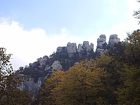
 Rocky outcrops at els Ports | |
| Highest point | |
| Peak | Mont Caro |
| Elevation | 1,441 m (4,728 ft) |
| Listing | List of mountains in Aragon |
| Coordinates | 40°48′28″N 0°19′07″E / 40.80778°N 0.31861°E |
| Geography | |
| Country | Spain |
| Communities | Aragon, Catalonia and Valencia |
| Comarca | Matarranya, Baix Ebre, Montsià and Baix Maestrat |
| Parent range | Iberian System, eastern zone |
| Geology | |
| Orogeny | Alpine orogeny |
| Rock age | Cretaceous |
| Rock type | Karstic |
| Climbing | |
| Easiest route | Drive from Roquetes on the western side or from Beseit on the eastern |

Ports de Tortosa-Beseit (Catalan pronunciation: [ˈpɔɾdz ðə tuɾˈtozə βəˈzejt]), also known as Ports de Beseit, or simply as Els Ports [əls ˈpɔɾts] or Lo Port [lu ˈpɔɾt] by locals, is a limestone mountain massif located at the north-eastern end of the Sistema Ibérico, a complex system of mountain ranges and massifs in the centre of the Iberian Peninsula. Its highest point is Mont Caro, 1,441 m.[1] Rivers such as the Matarranya and the Cenia have their source in these mountains.
- ^ "Mapa Topogràfic de Catalunya". Institut Cartogràfic de Catalunya. Retrieved 9 September 2010..
