| Geography | |
|---|---|
| Location | Bay of Bengal |
| Coordinates | 14°52′30″N 93°37′48″E / 14.875°N 93.63°E |
| Adjacent to | Andaman Sea |
| Total islands | 3 |
| Major islands |
|
| Area | 8.1 km2 (3.1 sq mi) |
| Length | 7.7 km (4.78 mi) |
| Width | 1.8 km (1.12 mi) |
| Highest elevation | 81 m (266 ft) |
| Administration | |
| Region | Yangon |
| District | South Yangon |
| Township | Cocokyun |
| Ward | Preparis Ward |
| Largest settlement | Preparis (pop. 50) |
| Demographics | |
| Population | 50 (2014) |
| Pop. density | 6.2/km2 (16.1/sq mi) |
| Ethnic groups | Bamar people |
| Additional information | |
| Time zone | |
| ISO code | MM-06 |
| Official website | www |
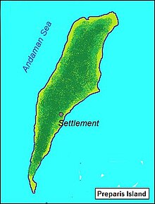
Preparis Island is an island which is part of the Yangon Region of Myanmar. Together, with the other Andaman Islands (the majority of which are a union territory of India), it marks the boundary between the Bay of Bengal and the Andaman Sea. The island has a population of 50 and a total area of 8.1 km2 (3.1 sq mi).
The island is 133 km (83 mi) to the SSW of Cape Negrais, the nearest point on the Myanmar mainland and 340 km (210 mi) south of the capital, Yangon. The five Coco Islands (also part of Myanmar) are 77 km (48 mi) to the south.


