 Part of Prins Hendrikkade viewed from the north, with the Schreierstoren (left), the northern end of Geldersekade canal (centre), and the Basilica of Saint Nicholas (right) | |
| Location | Amsterdam, Netherlands |
|---|---|
| Postal code | 1011 AG-AW, 1011 TB-TD, 1011 VC, 1012 AC-AE, 1012 TK-TM |
| Coordinates | 52°22′25″N 4°54′22″E / 52.37361°N 4.90611°E |
| West end | Singel canal, Haarlemmersluis |
| East end | Kattenburgerplein |
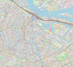
Prins Hendrikkade (Dutch for "Prince Henry's Quay") is a major street in the centre of Amsterdam. It passes Amsterdam Central Station, intersects the Damrak at the mouth of the Amstel river, and forms the southern end of the IJtunnel across the IJ bay. The street formed the northern edge and outer harbour of the city until the 19th century. It was named after Prince Henry of the Netherlands, youngest son of King William II, following Henry's death in 1879.
The Prins Hendrikkade runs roughly northwest to southeast, from the northern end of Singel canal to Kattenburgerplein square. Car traffic is banned from the part of the street directly in front of Amsterdam Central Station, between Martelaarsgracht and Damrak. The street continues in westerly direction as Nieuwe Westerdokstraat and Haarlemmerhouttuinen. At the eastern end, the street turns north at Kattenburgerplein and continues as Kattenburgerstraat. The body of water between Prins Hendrikkade and the train station is known as Open Havenfront and, further east, as Oosterdok.
Along the street are 99 buildings that have been listed as national monument (rijksmonument).[1] Prominent buildings on the street include the Basilica of Saint Nicholas, the Schreierstoren, the Scheepvaarthuis, and Victoria Hotel. Along the eastern part of the street are a number of quays where houseboats are moored.

Prins Hendrikkade has been depicted by various artists, including Claude Monet, who painted it in 1874.
- ^ Rijksmonumentenregister (in Dutch)
