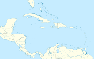
Puerto Rico Bank and major surrounding geological features | |
| Geography | |
| Location | Caribbean |
| Coordinates | 18°17′00″N 65°36′00″W / 18.28333°N 65.60000°W |
| Archipelago | Puerto Rico Virgin Islands |
| Area | 21.000 km2 (8.108 sq mi) |
| Administration | |
| Islands and Cays | 140[a] |
| Islands and Cays | 52[b][1] |
| Islands and Cays | 36[1] |
The Puerto Rico Bank (PRB) (Spanish: Banco de Puerto Rico), also known as the Puerto Rican Bank (PRB), is a carbonate platform and insular shelf comprising the archipelagos of Puerto Rico[a] and the Virgin Islands,[b] located between the Greater Antilles and the Lesser Antilles in the northeastern Caribbean.[2][3][4][5][6][7][8][9] Last subaerially exposed from the Last Glacial Maximum in the Last Glacial Period of the Late Pleistocene Age to the Northgrippian Age of the Holocene Epoch, the bank connected Puerto Rico and the Virgin Islands into a single landmass until sea level rise fragmented it into the present-day islands between 10,000 to 7,000 years Before Present (8,050 to 5,050 years Before Christ).[10][11][12][13][14][15] It is within the Puerto Rico-Virgin Islands Microplate between the North American Plate and Caribbean Plate.
Cite error: There are <ref group=lower-alpha> tags or {{efn}} templates on this page, but the references will not show without a {{reflist|group=lower-alpha}} template or {{notelist}} template (see the help page).
- ^ a b "Where is the U.S. Virgin Islands: Geography". Virgin Islands. Retrieved 2024-10-05.
- ^ "Marine Regions · Puerto Rico Trench (Trench)". www.marineregions.org. Retrieved 2024-09-26.
- ^ "Geology and Hydrogeology of the Caribbean Islands Aquifer System of the Commonwealth of Puerto Rico and the U.S. Virgin Islands" (PDF). U.S. Geology Survey. Retrieved 8 October 2024.
- ^ "Archipelagic genetics in a widespread Caribbean anole" (PDF). Wiley Online Library. Retrieved 8 October 2024.
- ^ "The Bunce Fault and Strain Partitioning in the Northern Lesser Antilles". ResearchGate. Retrieved 8 October 2024.
- ^ "Sea level, topography and island diversity: Phylogeography of the Puerto Rican Red-eyed Coquí, Eleutherodactylus antillensis". ResearchGate. Retrieved 8 October 2024.
- ^ "The polyphased tectonic evolution of the Anegada Passage in the northern Lesser Antilles subduction zone". ResearchGate. Retrieved 24 September 2024.
- ^ "Exploring Puerto Rico's Seamounts, Trenches, and Troughs: Background: Mission Plan". NOAA Office of Ocean Exploration and Research. Retrieved 2024-08-27.
- ^ "Island lists of West Indian amphibians and reptiles" (PDF). Florida Museum of Natural History. pp. 137–147.
- ^ "Biogeography of Puerto Rican Bank". ResearchGate. Retrieved 8 October 2024.
- ^ "Boraginaceae Varronia rupicola (Urb.) Brtton : biogeog- raphy, systematic placement and conservation genetics of a threatened species endemic to the Caribbean" (PDF). Birkbeck Institutional Research Online. pp. 86–87. Retrieved 8 October 2024.
- ^ "The beetles of the Lesser Antilles (Insecta, Coleoptera): diversity and distributions" (PDF). DigitalCommons. pp. 10 and 16. Retrieved 8 October 2024.
- ^ "Por el camino verde: Long-term tropical socioecosystem dynamics and the Anthropocene as seen from Puerto Rico". Research Gate. Retrieved 24 August 2024.
- ^ "Bats of St. Vincent, Lesser Antilles". ResearchGate. Retrieved 8 October 2024.
- ^ "The Late Pleistocene Human Settlement of Interior North America: The Role of Physiography and Sea Level Change". ResearchGate. Retrieved 8 October 2024.


