 Highway 24 | ||||
|---|---|---|---|---|
| Ruta 24 | ||||
| Route information | ||||
| Maintained by Puerto Rico DTPW | ||||
| Length | 1.7 km[1] (1.1 mi) | |||
| Major junctions | ||||
| South end | ||||
| North end | ||||
| Location | ||||
| Country | United States | |||
| Territory | Puerto Rico | |||
| Municipalities | Guaynabo, Cataño | |||
| Highway system | ||||
| ||||
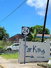
Puerto Rico Highway 24 (PR-24) is a north–south road located between the municipalities of Cataño and Guaynabo, Puerto Rico.[2] This highway extends from Avenida Las Nereidas (PR-888) in downtown Cataño to Avenida El Caño (PR-165) near the Metropolitan Detention Center, Guaynabo. In Cataño, it is known as Calle Wilson,[3] and in Guaynabo, as Avenida Juan Ponce de León.[4]
- Puerto Rico Highway 24
-
 Heading north in Amelia, Guaynabo
 -
 Heading north in downtown Cataño

.jpg)
- ^ Cite error: The named reference
googlewas invoked but never defined (see the help page). - ^ National Geographic Maps (2011). Puerto Rico (Map). 1:125,000. Adventure Map (Book 3107). Evergreen, Colorado: National Geographic Maps. ISBN 978-1566955188. OCLC 756511572.
- ^ "Calle Wilson, Barrio Pueblo". www.cartogiraffe.com. Retrieved 1 February 2022.
- ^ "Avenida Juan Ponce de León, Cataño, Puerto Rico" (Map). geoview.info. Retrieved 5 May 2019.