| Puncak Trikora | |
|---|---|
| Ettiakup | |
 Puncak Trikora from north. Main summit (center left) and west ridge (right) | |
| Highest point | |
| Elevation | 4,750 m (15,580 ft) |
| Prominence | 1,268 m (4,160 ft) |
| Listing | |
| Coordinates | 4°15′44″S 138°40′54″E / 4.26222°S 138.68167°E |
| Geography | |
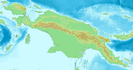
Location in Western New Guinea Location in New Guinea | |
| Location | Highland Papua, Indonesia |
| Parent range | Maoke Mountains |
| Climbing | |
| First ascent | 21 February 1913 by Franssen Herderschee, Hubrecht and Versteeg |
Puncak Trikora (literally "Peak [[Operation People's Tri-Commando") is a 4,730 or 4,750-metre-high (15,584 ft) mountain in the Highland Papua province of Indonesia on New Guinea. It lies in the eastern part of the Sudirman (Nassau) Range of the Maoke Mountains.
Behind Puncak Jaya (Carstensz Pyramid) at 4,884 m (16,024 ft), it is either the second or third highest mountain on the island of New Guinea and the Australasian continent. As such it appears on some Seven Second Summits lists, although SRTM-data support that Puncak Mandala (Juliana Peak) in the Jayawijaya (Orange) Range is higher with 4,760 m (15,617 ft).[notes 1][notes 2]
Cite error: There are <ref group=notes> tags on this page, but the references will not show without a {{reflist|group=notes}} template (see the help page).


