This article includes a list of general references, but it lacks sufficient corresponding inline citations. (August 2023) |
Punta Cana | |
|---|---|
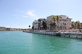
 Cap Cana Marina area in Punta Cana, Dominican Republic | |
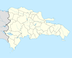
| Coordinates: 18°32′N 68°22′W / 18.533°N 68.367°W | |
| Country | Dominican Republic |
| Province | La Altagracia Province |
| Municipality | Higüey |
| Incorporated (town) | 27 June 2006[1] |
| Government | |
| • Director of Verón–Punta Cana | Ramón Antonio Ramírez (Dominican Liberation Party, 2016–2028) |
| Area | |
| • Total | 475.3 km2 (183.5 sq mi) |
| Population (2022)[4] | |
| • Total | 138,919 |
| • Density | 290/km2 (760/sq mi) |
| Time zone | UTC−4 (Atlantic) |
| Area code(s) | 809, 829, and 849 |
Punta Cana is a resort town in the easternmost region of the Dominican Republic. It was politically incorporated as the "Verón–Punta Cana township" in 2006, and it is subject to the municipality of Higüey (La Altagracia Province). According to the 2022 census, this township or district had a population of 138,919 inhabitants.[5]
Punta Cana is the second-most popular tourist destination in Latin America, with more visitors than any other city in the Caribbean region.[citation needed] The Punta Cana International Airport (PUJ) is located about 3 kilometres (1.9 mi) inland, on the highway that leads from Higüey to La Romana. This airport receives 64% of all flights that arrive in the Dominican Republic, receiving more passengers than the Las Américas International Airport, located in Santo Domingo, the country's capital.
The area is known for its white sand beaches, blue turquoise waters, and balnearios which face both the Caribbean Sea and the Atlantic Ocean. The weather is hot for most of the year, especially in late summer and autumn when the Northern Tropics receive their most direct sunlight.
- ^ (in Spanish) Law -2006. Senate of the Dominican Republic.
- ^ Rodríguez, Ramón (16 March 2020). "Cholitín celebra victoria electoral como nuevo alcalde de Higüey". Diario Libre.
- ^ González, Julio (March 16, 2020). "¿Quién es Ramón Ramírez, el virtual ganador de la Dirección Distrital de Verón-Punta Cana?".
- ^ a b (in Spanish) 9th Census of Population and Housing (2010), General Report Archived 2012-12-02 at the Wayback Machine. National Bureau of Statistics.
- ^ X Censo de Población y Vivienda, 2022 Oficina Nacional de Estadistica

