Puntarenas | |
|---|---|
|
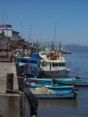
Images, from top down, left to right: the Port Laborer Monument, Tourists Pass Avenue, The Cathedral within Central Park, Coral Princess docked at Puntarenas' Port, docked fishing boats, Puntarenas Pier. | |
| Nickname(s): La Perla del Pacífico "The Pacific Pearl" | |
 Puntarenas and surrounding area | |
| Coordinates: 9°58′N 84°50′W / 9.967°N 84.833°W | |
| Country | Costa Rica |
| Province | Puntarenas |
| Canton | Puntarenas |
| Districts | Puntarenas, Chacarita, El Roble |
| Creation | 17 September 1858 |
| Area | |
| • Total | 47.46 km2 (18.32 sq mi) |
| Elevation | 5 m (16 ft) |
| Population (2011) | |
| • Total | 41,528 |
| • Density | 880/km2 (2,300/sq mi) |
| • Demonym | Puntarenense |
| Time zone | UTC-6 (Central) |
| Postal code | 60101, 60112, 60115 |
| Area code | + 506 |
| Climate | Aw |
| Website | [1](in Spanish) |
Puntarenas (Spanish pronunciation: [puntaˈɾenas]) is a city in the Puntarenas Province, on the Pacific coast of Costa Rica. As the seat of the Municipality of Puntarenas canton, it is awarded the title of city, which comprises the Puntarenas, Chacarita and El Roble districts.[1][2] As the city of the first canton of the province, it is the capital city of the Puntarenas Province as well, according to the Administrative divisions of Costa Rica.
- ^ "Declara oficial para efectos administrativos, la aprobación de la División Territorial Administrativa de la República N°41548-MGP". Sistema Costarricense de Información Jurídica (in Spanish). 19 March 2019. Retrieved 26 September 2020.
- ^ División Territorial Administrativa de la República de Costa Rica (PDF) (in Spanish). Editorial Digital de la Imprenta Nacional. 8 March 2017. ISBN 978-9977-58-477-5.


