Putnam County | |
|---|---|
 Putnam County Courthouse in Winfield | |
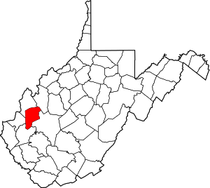
 Location within the U.S. state of West Virginia | |
 West Virginia's location within the U.S. | |
| Coordinates: 38°31′N 81°55′W / 38.51°N 81.91°W | |
| Country | |
| State | |
| Founded | March 11, 1848 |
| Named for | Israel Putnam |
| Seat | Winfield |
| Largest city | Hurricane |
| Area | |
| • Total | 350 sq mi (900 km2) |
| • Land | 346 sq mi (900 km2) |
| • Water | 4.7 sq mi (12 km2) 1.3% |
| Population (2020) | |
| • Total | 57,440 |
| • Estimate (2021) | 57,260 |
| • Density | 160/sq mi (63/km2) |
| Time zone | UTC−5 (Eastern) |
| • Summer (DST) | UTC−4 (EDT) |
| Congressional district | 2nd |
| Website | putnamcountywv |
Putnam County is a county in the U.S. state of West Virginia. As of the 2020 census, the population was 57,440.[1] Its county seat is Winfield, its largest incorporated city is Hurricane, and its largest community is the census-designated place of Teays Valley.[2] Putnam County is part of the Huntington–Ashland, WV-KY-OH Metropolitan Statistical Area, across the Kanawha River from Charleston, West Virginia.
- ^ "State & County QuickFacts". United States Census Bureau. Retrieved August 14, 2022.
- ^ "Find a County". National Association of Counties. Retrieved June 7, 2011.