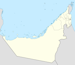
Qada'ah
ديرة الكداءة (Arabic) | |
|---|---|
 Qada'ah. Village located in the mountains of Ras Al Khaimah (UAE), south of Jabal Qada'ah. | |
| Coordinates: 25°45′01.58″N 56°08′47.29″E / 25.7504389°N 56.1464694°E | |
| Country | |
| Emirate | |
| Area | |
| • Total | 0.25 km2 (0.10 sq mi) |
| Elevation | 870 m (2,850 ft) |
| Time zone | UTC+04:00 |
Qada'ah (Arabic: ديرة الكداءة, romanized: Kidā'ah)[1] is a small agricultural and livestock village, located in the northeast of the United Arab Emirates (UAE), in the Hajar Mountains, Emirate of Ras Al Khaimah, at an approximate altitude of 870 m (2,850 ft), and just over a kilometer from the border with the neighboring Sultanate of Oman.
The village has about 20 houses, some of them rebuilt and renovated following a traditional style; embankments and terraces supported by dry stone walls, without mortar, which allow water and soil to be retained, intended for cereal planting and other agricultural uses; pipes to collect runoff water; cisterns; sheepfolds; barns and other buildings. Most habitable homes are used as second homes by their owners.
Access to Qada'ah is only possible on foot or with donkeys, generally using a rocky and steep donkey path that starts from the village of Danam,[2] located west-northwest of Qada'ah, on the banks of the Wadi Qada'ah.

The small plateau, on which the town of Qada'ah extends, constitutes a formidable watchtower from which one can observe, to the west, a good part of the middle and lower reaches of the Wadi Qada'ah and even the coast of the Persian Gulf; to the north, the southern slope of Jabal Al Ahqab (Jabal Qada'ah); and to the east some sectors of the upper course of the Wadi Qada'ah and the cliffs and mountain ridge that serve as a reference for the border limit with Oman.
- ^ Jāmiʻat al-Imārāt al-ʻArabīyah al-Muttaḥidah. Geoprojects (U.K.) Ltd., The National atlas of the United Arab Emirates, Al Ain : United Arab Emirates University - 1993
- ^ Lancaster, William, 1938- (2011). Honour is in contentment : life before oil in Ras al-Khaimah (UAE) and some neighbouring regions. Lancaster, Fidelity. Berlin: De Gruyter. p. 499. ISBN 978-3-11-022340-8. OCLC 763160662.
{{cite book}}: CS1 maint: multiple names: authors list (link) CS1 maint: numeric names: authors list (link)


