| Queen Louise Land | |
|---|---|
| Nuna Dronning Louise Dronning Louise Land | |
 Queen Louise Land ONC map section. | |
| Highest point | |
| Peak | Gefiontinde |
| Elevation | 2,364 m (7,756 ft) |
| Dimensions | |
| Length | 185 km (115 mi) N/S |
| Width | 73 km (45 mi) E/W |
| Area | 12,000 km2 (4,600 sq mi) |
| Geography | |
| Country | Greenland |
| Range coordinates | 76°40′N 24°30′W / 76.667°N 24.500°W |
| Geology | |
| Orogeny | Caledonian orogeny[1] |
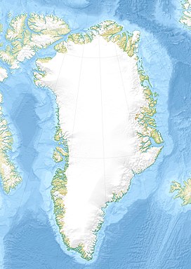
Queen Louise Land (Danish: Dronning Louise Land;[2] Greenlandic: Nuna Dronning Louise)[3] is a vast mountainous region located west of Dove Bay, King Frederik VIII Land, northeastern Greenland. Administratively it is part of the Northeast Greenland National Park zone.
The highest point of Queen Louise Land is Gefiontinde,[4] with a height of 2,364.3 m (7,757 ft), the highest of the Gefiontinder group of peaks located at 76°28′8″N 25°38′31″W / 76.46889°N 25.64194°W.[5][6]
Geologically Queen Louise Land is made up of orthogneiss overlain by sedimentary rocks.[7]
- ^ Regional Caledonian structure within an oblique convergence zone, Dronning Louise Land, NE Greenland, Journal of the Geological Society
- ^ "Dronning Louise Land". Mapcarta. Retrieved 2 July 2016.
- ^ Den grønlandske Lods - Geodatastyrelsen
- ^ Cite error: The named reference
Gmwas invoked but never defined (see the help page). - ^ Google Earth
- ^ Greenland Expedition - Dronning Louise Land
- ^ Harold Williams, Geology of the Appalachian—Caledonian Orogen in Canada and Greenland, p. 896]
