Qula
قولة Kouleh[1] Cola, Chola | |
|---|---|
 The remains of the Crusader tower at Qula. The village mosque was located about 10m to the east of it. | |
| Etymology: from a personal name[2] | |
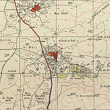
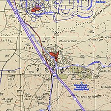
A series of historical maps of the area around Qula (click the buttons) | |
Location within Mandatory Palestine | |
| Coordinates: 32°02′15″N 34°57′20″E / 32.03750°N 34.95556°E | |
| Palestine grid | 146/160 |
| Geopolitical entity | Mandatory Palestine |
| Subdistrict | Ramle |
| Date of depopulation | 10 July 1948[5] |
| Area | |
| • Total | 4,347 dunams (4.347 km2 or 1.678 sq mi) |
| Population (1945) | |
| • Total | 1,010[3][4] |
| Cause(s) of depopulation | Military assault by Yishuv forces |
Qula (Arabic: قولة) was a Palestinian village in the Ramle Subdistrict of Mandatory Palestine, located 15 km northeast of Ramla. Its residents had their origins in Jimzu, Ammuriya and other places.[6]
Palestinian commander Hasan Salama, and his son Ali Hassan Salameh (1940-1979) were from Qula. The village was depopulated during the 1948 Arab-Israeli War.[7]
- ^ Guérin, 1875, p. 390
- ^ Palmer, 1881, p. 237
- ^ Government of Palestine, Department of Statistics, 1945, p. 30
- ^ Government of Palestine, Department of Statistics. Village Statistics, April, 1945. Quoted in Hadawi, 1970, p.68
- ^ Morris, 2004 p. xviii, village 211. Also gives cause of depopulation.
- ^ Grossman, D. (1986). "Oscillations in the Rural Settlement of Samaria and Judaea in the Ottoman Period". in Shomron studies. Dar, S., Safrai, S., (eds). Tel Aviv: Hakibbutz Hameuchad Publishing House. p. 375
- ^ "Welcome to Qula". Palestine Remembered. Retrieved 2007-12-09.


