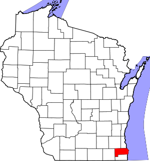
Racine County | |
|---|---|
 | |
 Location within the U.S. state of Wisconsin | |
 Wisconsin's location within the U.S. | |
| Coordinates: 42°47′N 87°46′W / 42.78°N 87.76°W | |
| Country | |
| State | |
| Founded | December 7, 1836 |
| Seat | Racine |
| Largest city | Racine |
| Area | |
• Total | 792 sq mi (2,050 km2) |
| • Land | 333 sq mi (860 km2) |
| • Water | 460 sq mi (1,200 km2) 58% |
| Population | |
• Total | 197,727 |
• Estimate (2023) | 196,613 |
| • Density | 594.4/sq mi (229.5/km2) |
| Time zone | UTC−6 (Central) |
| • Summer (DST) | UTC−5 (CDT) |
| Congressional district | 1st |
| Website | www |
Racine County (/rəˈsiːn, reɪ-/ rə-SEEN, ray-) is a county in southeastern Wisconsin. As of the 2020 census, its population was 197,727,[1] making it Wisconsin's fifth-most populous county. Its county seat is Racine.[2] The county was founded in 1836, then a part of the Wisconsin Territory. Racine County comprises the Racine metropolitan statistical area. This area is part of the Milwaukee-Racine-Waukesha combined statistical area.[3] According to the U.S. Census Bureau, the county has an area of 792 square miles (2,050 km2), of which 333 square miles (860 km2) is land and 460 square miles (1,200 km2) (58%) is water.[4] The county's unemployment rate was 5.6% in June 2021.[5]
- ^ a b Cite error: The named reference
2020-census-55101was invoked but never defined (see the help page). - ^ "Find a County". National Association of Counties. Retrieved June 7, 2011.
- ^ US Department of Commerce Economic & Statistics Administration; US Census Bureau (January 2012). "Milwaukee-Racine-Waukesha, WI Combined Statistical Area" (PDF). Census.gov. Archived (PDF) from the original on October 9, 2022. Retrieved July 8, 2021.
- ^ "2010 Census Gazetteer Files". United States Census Bureau. August 22, 2012. Retrieved August 8, 2015.
- ^ "Unemployment in the United States". Local Area Unemployment Statistics Map. Retrieved August 8, 2021.
