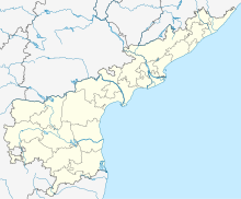
Rajahmundry Airport | |||||||||||
|---|---|---|---|---|---|---|---|---|---|---|---|
 | |||||||||||
| Summary | |||||||||||
| Airport type | Public | ||||||||||
| Operator | Airports Authority of India | ||||||||||
| Serves | Rajamahendravaram | ||||||||||
| Location | Madhurapudi, Rajamahendravaram, Andhra Pradesh, India | ||||||||||
| Elevation AMSL | 151 ft / 46 m | ||||||||||
| Coordinates | 17°06′37″N 081°49′06″E / 17.11028°N 81.81833°E | ||||||||||
| Website | Rajahmundry Airport | ||||||||||
| Map | |||||||||||
| Runways | |||||||||||
| |||||||||||
| Statistics (April 2023 - March 2024) | |||||||||||
| |||||||||||
Rajahmundry Airport (IATA: RJA, ICAO: VORY) is a domestic airport serving the city of Rajamahendravaram, Andhra Pradesh, India. It is located at Madhurapudi, 16 km (9.9 mi) north from the city centre, on National Highway 516E. Before modernisation, it was used by Vayudoot. It is heavily used by the helicopters of Oil and Natural Gas Corporation (ONGC) and other government agencies for offshore oil exploration operations.[4]
- ^ "Annexure III – Passenger Data" (PDF). aai.aero. Retrieved 24 April 2024.
- ^ "Annexure II – Aircraft Movement Data" (PDF). aai.aero. Retrieved 24 April 2024.
- ^ "Annexure IV – Freight Movement Data" (PDF). aai.aero. Retrieved 24 April 2024.
- ^ "Night landing facility soon at Rajahmundry". The Hindu. 29 May 2008. Archived from the original on 9 April 2021. Retrieved 9 April 2021.

