This article needs additional citations for verification. (January 2017) |
Rangamati | |
|---|---|
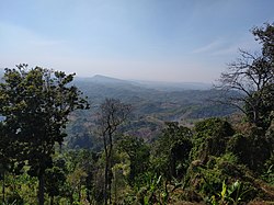
 View of the Sajek Valley | |
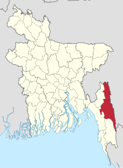
 Location of Rangamati District within Bangladesh | |
 Expandable map of Rangamati District | |
| Coordinates: 22°38′N 92°12′E / 22.633°N 92.200°E | |
| Country | |
| Division | Chittagong Division |
| Capital | Rangamati |
| Government | |
| • Member of the Parliament | Vacant |
| • Deputy Commissioner | Mohammad Mizanur Rahman |
| • Chief Executive Officer | S. M. Zakir Hossain [1] |
| • Pouroshava Mayor | Akbar Hossain Chowdhury |
| Area | |
| • Total | 6,116.11 km2 (2,361.44 sq mi) |
| • Land | 4,824.63 km2 (1,862.80 sq mi) |
| • Water | 1,291.5 km2 (498.7 sq mi) |
| • Rank | 1 (Largest District of Bangladesh) |
| Elevation | 17 m (56 ft) |
| Population | |
| • Total | 647,587 |
| • Rank | 62 (Among 64) |
| • Density | 110/km2 (270/sq mi) |
| Time zone | UTC+6 (BST) |
| Postal Code | 4500 |
| Area code | 0351 |
| HDI (2018) | 0.593[4] medium · 14th of 21 |
| Website | www |
| Population & Area related info taken from রাঙ্গামাটি জেলা তথ্য বাতায়নে আপনাকে স্বাগতম [Welcome to the Rangamati district portal]. Deputy Commissioner Rangamati (in Bengali). Archived from the original on 17 January 2013. | |
Rangamati District (Bengali: রাঙ্গামাটি জেলা) is a district in south-eastern Bangladesh. It is a part of the Chattogram Division,[5] and the town of Rangamati serves as the headquarters of the district. By area, Rangamati is the largest district of the country.
- ^ "রাঙ্গামাটি জেলা".
- ^ "Rangamati, Bangladesh Page". Global Gazetteer. Falling Rain.
- ^ Cite error: The named reference
2022census-prelimwas invoked but never defined (see the help page). - ^ "Sub-national HDI - Area Database - Global Data Lab". hdi.globaldatalab.org. Retrieved 18 March 2020.
- ^ Atikur Rahman (2012). "Rangamati District". In Sirajul Islam and Ahmed A. Jamal (ed.). Banglapedia: National Encyclopedia of Bangladesh (2nd ed.). Asiatic Society of Bangladesh.