Rangat | |
|---|---|
village | |
| Coordinates: 12°30′11″N 92°54′48″E / 12.50306°N 92.91333°E | |
| Country | |
| Union Territory | |
| District | Andaman |
| Population | |
| • Total | 38,824 (2,001 census) |
| Languages | |
| • Official | Hindi, English |
| Time zone | UTC+5:30 (IST) |
| PIN | 744205 |
| Telephone code | 03192 |
| Nearest city | Port Blair |
| Climate | Am |
| Website | and.nic.in |
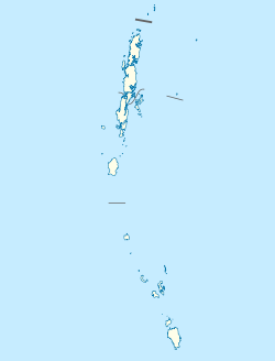
Rangat is a town on the Middle Andaman Island, Andaman Archipelago. It is also one of the three counties (tehsils) administrative divisions of the North and Middle Andaman district, in the Andaman and Nicobar Islands union territory of India. Its population, according to the 2001 Census of India, was 38,824 people, mainly of Bengalis and Tamils.
Rangat is 210 km from Port Blair and 70 km south of Mayabunder. The town is well connected by road and sea routes.[1]

