Rat Burana
ราษฎร์บูรณะ | |
|---|---|
 KBank Head Office, located at the foot of the Rama IX Bridge near the Chao Phraya River, Rat Burana | |
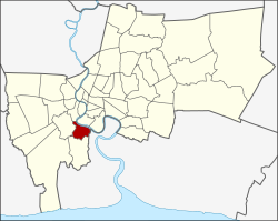
 Khet location in Bangkok | |
| Coordinates: 13°40′56″N 100°30′20″E / 13.68222°N 100.50556°E | |
| Country | |
| Province | Bangkok |
| Seat | Rat Burana |
| Khwaeng | 2 |
| Area | |
| • Total | 15.782 km2 (6.093 sq mi) |
| Population (2017) | |
| • Total | 82,545[1] |
| • Density | 5,230.32/km2 (13,546.5/sq mi) |
| Time zone | UTC+7 (THA) |
| Postal code | 10140 |
| Geocode | 1024 |
Rat Burana (Thai: ราษฎร์บูรณะ, pronounced [râːt būːrānáʔ]) is one of the 50 districts (khet) of Bangkok, Thailand. The district is bounded by (clockwise from east to north) Phra Pradaeng of Samut Prakan province, Thung Khru, Chom Thong and Thon Buri districts of Bangkok while its north to east is Chao Phraya River with (clockwise) Bang Kho Laem and Yan Nawa districts across the river.
- ^ "Population and House Report for Year 2017". Department of Provincial Administration, Ministry of Internal Affairs. Retrieved 2018-04-01. (Search page)