This article needs additional citations for verification. (November 2007) |
| Red Cliffs Victoria | |||||||||||||||
|---|---|---|---|---|---|---|---|---|---|---|---|---|---|---|---|
 Post office | |||||||||||||||
| Coordinates | 34°18′27″S 142°11′17″E / 34.30750°S 142.18806°E | ||||||||||||||
| Population | 6,138 (2021 census)[1] | ||||||||||||||
| Postcode(s) | 3496 | ||||||||||||||
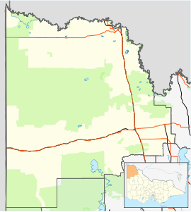
| Location | |||||||||||||||
| LGA(s) | Rural City of Mildura | ||||||||||||||
| Region | Sunraysia | ||||||||||||||
| State electorate(s) | Mildura | ||||||||||||||
| Federal division(s) | Mallee | ||||||||||||||
| |||||||||||||||
Red Cliffs is a town in Victoria, Australia in the Sunraysia region. It is located on the Calder Highway, 16 km south of Mildura and 544 km north-west of Melbourne.
At the 2016 census, Red Cliffs had a population of 5,060.[1] The main industry is the growing of grapes and citrus. Red Cliffs takes its name from the 70 m cliffs 4.5 km east of the town that have a red/orange colour.
- ^ a b "Red Cliffs – 2021 Census All persons QuickStats". Australian Bureau of Statistics. Retrieved 23 September 2022.
- ^ "Travelmate". Archived from the original on 1 May 2001. Retrieved 20 June 2008.
