Red Rock, Oklahoma
Chína Ino Šúje | |
|---|---|
 7 Clans Casino Sign, Red Rock, Oklahoma | |
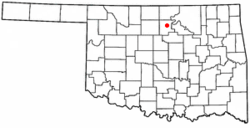
 Location of Red Rock, Oklahoma | |
| Coordinates: 36°27′36″N 97°10′47″W / 36.46000°N 97.17972°W | |
| Country | United States |
| State | Oklahoma |
| County | Noble |
| Area | |
| • Total | 0.25 sq mi (0.64 km2) |
| • Land | 0.25 sq mi (0.64 km2) |
| • Water | 0.00 sq mi (0.00 km2) |
| Elevation | 915 ft (279 m) |
| Population (2020) | |
| • Total | 245 |
| • Density | 987.90/sq mi (381.20/km2) |
| Time zone | UTC-6 (Central (CST)) |
| • Summer (DST) | UTC-5 (CDT) |
| ZIP code | 74651 |
| Area code | 580 |
| FIPS code | 40-62650[3] |
| GNIS feature ID | 2412538[2] |
Red Rock (Iowa-Oto: Chína Ino Šúje pronounced ĩꜜno suꜜdʒɛ, meaning "Rock Red town") is a town in northern Noble County, Oklahoma, United States. The population was 283 at the 2010 census, a decline from 293 at the 2000 census. The headquarters of the Otoe-Missouria Tribe of Indians is located in Red Rock.[4]
- ^ "ArcGIS REST Services Directory". United States Census Bureau. Retrieved September 20, 2022.
- ^ a b U.S. Geological Survey Geographic Names Information System: Red Rock, Oklahoma
- ^ "U.S. Census website". United States Census Bureau. Retrieved January 31, 2008.
- ^ Betty L. Waters, "Red Rock," Encyclopedia of Oklahoma History and Culture. Accessed March 29, 2015.