Red Sea State
ولاية البحر الأحمر Wilāyat al-Baḥr al-ʾAḥmar | |
|---|---|
 Port Sudan | |
 Location in Sudan. | |
| Coordinates: 19°35′N 35°37′E / 19.583°N 35.617°E | |
| Country | |
| Region | Eastern Sudan States Coordinating Council |
| Capital | Port Sudan |
| Government | |
| • Governor | Vacant |
| Area | |
| • Total | 218,887 km2 (84,513 sq mi) |
| Population (2018) | |
| • Total | 1,482,053[1] |
| • Density | 6.6/km2 (17/sq mi) |
| Time zone | UTC+2 (CAT) |
| HDI (2017) | 0.518[2] low |
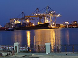
Red Sea State (Arabic: ولاية البحر الأحمر Wilayat Al Baḥr al Aḥmar) is one of the 18 states of Sudan.[3] It has an area of 212,800 km2[4] and an estimated population of 1,482,053 in 2018. Port Sudan is the capital of the state.[4] Sudan claims, but does not control, the Halaib Triangle, a region disputed between Sudan and Egypt. The original inhabitants of the state are the Beja people who constitute more than 65% of the total population, with lower wealth and power in the region.
- ^ Sub-national Population Projections of Sudan and Age-Sex Composition. gov.sd
- ^ "Sub-national HDI - Area Database - Global Data Lab". hdi.globaldatalab.org. Retrieved 2018-09-13.
- ^ States of Sudan. statoids.com
- ^ a b "Red Sea State" on the Republic of Sudan website
