Reform | |
|---|---|
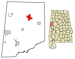
 Location of Reform in Pickens County, Alabama | |
| Coordinates: 33°22′51″N 88°0′54″W / 33.38083°N 88.01500°W | |
| Country | United States |
| State | Alabama |
| County | Pickens |
| Area | |
| • Total | 8.04 sq mi (20.82 km2) |
| • Land | 8.01 sq mi (20.74 km2) |
| • Water | 0.03 sq mi (0.07 km2) |
| Elevation | 240 ft (70 m) |
| Population (2020) | |
| • Total | 1,520 |
| • Density | 189.81/sq mi (73.28/km2) |
| Time zone | UTC-6 (Central (CST)) |
| • Summer (DST) | UTC-5 (CDT) |
| ZIP code | 35481 |
| Area code(s) | 205, 659 |
| FIPS code | 01-64104 |
| GNIS feature ID | 0125544 |
| Website | www |
Reform (/ˈriːfɔːrm/; REE-form) is a city in Pickens County, Alabama, United States. At the 2010 census the population was 1,702, down from 1,978 in 2000. It is located approximately halfway between Columbus, Mississippi and Tuscaloosa on U.S. Route 82.
- ^ "2020 U.S. Gazetteer Files". United States Census Bureau. Retrieved October 29, 2021.