Richvale | |
|---|---|
| Coordinates: 39°29′38″N 121°44′41″W / 39.49389°N 121.74472°W | |
| Country | United States |
| State | California |
| County | Butte County |
| Area | |
| • Total | 0.927 sq mi (2.401 km2) |
| • Land | 0.927 sq mi (2.401 km2) |
| • Water | 0 sq mi (0 km2) 0% |
| Elevation | 108 ft (33 m) |
| Population (2020)[3] | |
| • Total | 234 |
| • Density | 250/sq mi (97/km2) |
| Time zone | UTC-8 (Pacific (PST)) |
| • Summer (DST) | UTC-7 (PDT) |
| ZIP Code | 95974 |
| Area code | 530 |
| GNIS feature IDs | 231556; 2612486 |
| U.S. Geological Survey Geographic Names Information System: Richvale, California; U.S. Geological Survey Geographic Names Information System: Richvale, California | |
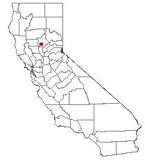
Richvale (also, Richland, Silbys Switch, Silsby) is a small census-designated place[4] (population 244) in Butte County, California, US, south of Chico and west of Oroville. The primary crop grown in the area surrounding Richvale is rice, irrigated from the Oroville Dam on the Feather River. Several farmers in the area are known for organic farming. The population was 244 at the 2010 census.

Richvale is located at 39° 29' 38" North, 121° 44' 41" West, 108 feet (33 m) above sea level.
The ZIP Code is 95974. The community is inside area code 530.
- ^ "2020 U.S. Gazetteer Files". United States Census Bureau. Retrieved August 30, 2023.
- ^ U.S. Geological Survey Geographic Names Information System: Richvale, California
- ^ "Richvale CDP, California". United States Census Bureau. Retrieved August 30, 2023.
- ^ U.S. Geological Survey Geographic Names Information System: Richvale, California
