Rifle Range | |
|---|---|
Neighbourhood of George Town | |
| Other transcription(s) | |
| • Malay | Padang Tembak (Rumi) |
| • Mandarin | 打枪埔 (Simplified) 打槍埔 (Traditional) Dǎ qiāng bù (Pinyin) |
| • Hokkien | Phah-tshèng-pōo (Tâi-lô) |
 | |
 | |
| Coordinates: 5°24′38″N 100°17′26″E / 5.41056°N 100.29056°E | |
| Country | |
| State | |
| City | |
| Founded | 1969 |
| Government | |
| • Local government | Penang Island City Council |
| • Mayor of Penang Island | Rajendran P. Anthony |
| • Kebun Bunga State Assemblyman | Lee Boon Heng (PKR) |
| • Bukit Bendera Member of Parliament | Syerleena Abdul Rashid (DAP) |
| Time zone | UTC+8 (MST) |
| • Summer (DST) | Not observed |
| Postal code | 11400, 11500 |
| Website | mbpp |
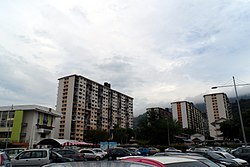
Rifle Range is a residential neighbourhood within the city of George Town in the Malaysian state of Penang. Located 4.4 km (2.7 mi) west of the city centre, the area was once home to a shooting range used by the British Army. The Malaysian federal government constructed nine blocks of low-cost public housing at the area in 1969, making them the first residential high-rises in Penang.[1][2][3] Until 1977, the Rifle Range flats were considered the tallest buildings in George Town.[4]
- ^ Cite error: The named reference
:4was invoked but never defined (see the help page). - ^ Cite error: The named reference
:5was invoked but never defined (see the help page). - ^ Cite error: The named reference
:3was invoked but never defined (see the help page). - ^ "Do you know...about Rifle Range Flats?". The Star. 23 Mar 2023. Retrieved 16 Oct 2024.
