| Rigolets | |
|---|---|
 The abandoned West Rigolets Light in 2004. It was destroyed by Hurricane Katrina in 2005. | |
 NOAA Coast Survey nautical map 2016 | |
| Location | |
| Country | United States |
| State | Louisiana |
| Physical characteristics | |
| Source | Lake Pontchartrain |
| • coordinates | 30°10′40″N 89°44′40″W / 30.177778°N 89.744444°W |
| Mouth | Lake Borgne |
• coordinates | 30°09′16″N 89°37′31″W / 30.154444°N 89.625278°W |
| Length | 8 mi (13 km) |
| Basin features | |
| Tributaries | |
| • left | Old Pearl River |
| • right | Sawmill Pass |
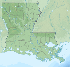
Rigolets is a 12.9-kilometre-long (8.0 mi) deepwater strait in Louisiana. "Rigolets" comes from the word rigole, French for 'trench' or 'gutter'. The name is now locally pronounced "RIG-uh-leez".
The strait begins at 30°10′40″N 89°44′40″W / 30.17778°N 89.74444°W and follows a generally eastward course to Lake Borgne, a lagoon in the Gulf of Mexico, and finally to the Gulf of Mexico, where it ends at 30°09′16″N 89°37′31″W / 30.15444°N 89.62528°W. Along with nearby Chef Menteur Pass, the Rigolets connects Lake Pontchartrain and Lake St. Catherine in Louisiana to Lake Borgne, and then to the Gulf of Mexico.[1][2] It forms the boundary between New Orleans (Orleans Parish) and St. Tammany Parish.
- ^ "The Rigolets". USGS Geographic Names Information System. Archived from the original on 2024-04-24. Retrieved 2006-04-17.
- ^ "Comprehensive Habitat Management Plan for the Lake Pontchartrain Basin" (PDF). Lake Pontchartrain Basin Foundation. 2005-11-18. Archived from the original (PDF) on 2006-03-16. Retrieved 2006-04-15.
