| Rio de Janeiro Metro | |||
|---|---|---|---|
 | |||
 | |||
| Overview | |||
| Native name | MetrôRio | ||
| Owner | Rio Trilhos (State of Rio de Janeiro) | ||
| Locale | Rio de Janeiro, RJ, Brazil | ||
| Transit type | Rapid transit | ||
| Number of lines | 3[1][2][3] | ||
| Number of stations | 41[1][3] | ||
| Daily ridership | 625 205 (2014)[4] | ||
| Annual ridership | 228.2 million (2014)[4] | ||
| Website | metrorio | ||
| Operation | |||
| Began operation | 5 March 1979[5] | ||
| Operator(s) | Concessão Metroviária do Rio de Janeiro S.A. (Mubadala Investment Company) | ||
| Technical | |||
| System length | 58 km (36 mi)[1][3] | ||
| Track gauge | 1,600 mm (5 ft 3 in) | ||
| |||
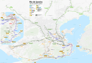
The Rio de Janeiro Metro (Portuguese: MetrôRio, Portuguese pronunciation: [meˌtɾo ˈʁi.u]), commonly referred to as just the Metrô (Portuguese pronunciation: [meˈtɾo]) is a rapid transit network that serves the city of Rio de Janeiro, Brazil. The Metrô was inaugurated on 5 March 1979, and consisted of five stations operating on a single line.[5] The system currently covers a total of 58 kilometres (36 mi),[3] serving 41 stations,[1][3] divided into three lines: Line 1 (16 kilometres (9.9 mi));[2] Line 2 (30.2 kilometres (18.8 mi)),[2] which together travel over a shared stretch of line that covers 10 stations[6] of an approximate distance of 5 kilometres (3.1 mi); and Line 4 (16 kilometres (9.9 mi)).[3] Metrô Rio has the second highest passenger volume of the metro systems in Brazil, after the São Paulo Metro.
Line 1 (orange line) serves downtown Rio, tourist areas in the South Zone, and several neighbourhoods in the North Zone. It is a semicircular line, and is fully underground. It runs from Uruguai Station to Ipanema/General Osório Station. Line 2 (green line) serves working-class residential neighborhoods extending toward the north. It is a northwest-to-southeast line, and almost completely above-ground (mostly at grade and partly elevated). This line started as a light rail, but due to increasing numbers of commuters, it gradually changed to rapid transit or metro. Because of its origin as light rail, it is at grade except for Estácio Station (the former connection station between lines 1 and 2), which is underground and Cidade Nova Station, which is elevated, and Line 4 (yellow line), connecting Barra da Tijuca/Jardim Oceânico Station in the West Zone to Ipanema/General Osório Station on Line 1.
The Government of the State of Rio de Janeiro remains responsible for the expansion of the metro network through Rio Trilhos. In late December 2007, the lease was renewed until 2038[7] and Metrô Rio assumed responsibility for the construction of Cidade Nova Station, which serves as a link between Line 2 and Line 1 ending the need to transfer stations, with the purchase of 114 cars, and construction of Uruguai Station, extending Line 1 further north.
The extension works of Line 2, called Line 1A, which ended the need for a transfer at Estácio Station and allowed the direct connection from Pavuna Station to Botafogo were started by Metrô Rio on 13 November 2008, and the tracks were completed in December 2009. With the extension, the 250 thousand passengers that circulate daily on Line 2 do not need to change trains any more in order to get to the South Zone. The interconnection of the two metro lines will reduce, by up to 13 minutes, the journey time from Pavuna station to the city's downtown, the destination of 83% of Line 2's passengers.[8]
- ^ a b c d "METRÔ RIO - Concessão Metroviára Do Rio De Janeiro S/A" [METRÔ RIO - Concession Metroviára Of Rio De Janeiro S/A] (PDF) (in Portuguese). MetrôRio. 31 December 2013. Archived (PDF) from the original on 3 January 2016. Retrieved 14 June 2014.
- ^ a b c "EXTENSÕES DAS LINHAS EM KILÔMETROS" [LENGTH OF THE LINES IN KILOMETERS] (in Portuguese). MetrôRio. Archived from the original on 16 October 2013. Retrieved 18 September 2013.
- ^ a b c d e f "Temer participa de inauguração da Linha 4 do Metrô no Rio" [President Temer takes part in inauguration of Rio's metro's line four] (in Portuguese). G1 Portal. 30 July 2016. Archived from the original (url) on 9 July 2019. Retrieved 30 July 2016.
- ^ a b "Relatório da Administração" (PDF) (in Brazilian Portuguese). 2014. Archived (PDF) from the original on 29 March 2017. Retrieved 19 February 2024.
- ^ a b "History - How it all began". MetrôRio. Archived from the original on 27 October 2016. Retrieved 14 June 2014.
- ^ "Maps". MetrôRio. Archived from the original on 23 April 2021. Retrieved 14 June 2014.
- ^ "MetrôRio". Invepar. Archived from the original on 16 December 2014. Retrieved 28 August 2014.
- ^ "Linha 2" (blog) (in Portuguese). Metrô do Rio (não oficial). Archived from the original on 17 May 2014. Retrieved 8 June 2014.[full citation needed]
