Rissa Municipality
Rissa kommune | |
|---|---|
| Rissen herred (historic name) | |
 View of the harbour at Råkvåg | |
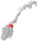
 Sør-Trøndelag within Norway | |
 Rissa within Sør-Trøndelag | |
| Coordinates: 63°39′20″N 10°02′23″E / 63.65556°N 10.03972°E | |
| Country | Norway |
| County | Sør-Trøndelag |
| District | Fosen |
| Established | 1860 |
| • Preceded by | Stadsbygd Municipality |
| Disestablished | 1 Jan 2018 |
| • Succeeded by | Indre Fosen Municipality |
| Administrative centre | Årnset |
| Area (upon dissolution) | |
| • Total | 621.37 km2 (239.91 sq mi) |
| • Land | 587.85 km2 (226.97 sq mi) |
| • Water | 33.52 km2 (12.94 sq mi) |
| • Rank | #179/426 in Norway |
| Population (2017) | |
| • Total | 6,628 |
| • Rank | #158/426 in Norway |
| • Density | 11.3/km2 (29/sq mi) |
| • Change (10 years) | |
| Demonym | Rissværing[1] |
| Official language | |
| • Norwegian form | Neutral |
| Time zone | UTC+01:00 (CET) |
| • Summer (DST) | UTC+02:00 (CEST) |
| ISO 3166 code | NO-1624[3] |
Rissa is a former municipality in the old Sør-Trøndelag county in Norway in the Fosen region. The municipality existed from 1860 until its dissolution on 1 January 2018 when it became part of the municipality of Indre Fosen in Trøndelag county. The administrative centre of the municipality was the village of Årnset. Other villages in the municipality included Askjem, Hasselvika, Husbysjøen, Rørvika, Råkvåg, and Stadsbygd.
Prior to its dissolution in 2018, the 621-square-kilometre (240 sq mi) municipality was the 179th largest by area out of the then 426 municipalities in Norway. Rissa was the 158th most populous municipality in Norway with a population of 6,628. The municipality's population density was 11.3 inhabitants per square kilometre (29/sq mi) and its population had increased by 4.1% over the last decade.[4]
The municipality was located on the southern end of the Fosen peninsula along the Trondheimsfjord and the Stjørnfjord. The large lake Storvatnet lies on the eastern border with Lensvik. To the north were the municipalities of Åfjord, Bjugn, and Ørland.
The Flakk–Rørvik Ferry crosses the Trondheimsfjord connecting the village of Rørvik with the city of Trondheim.
- ^ "Navn på steder og personer: Innbyggjarnamn" (in Norwegian). Språkrådet.
- ^ "Forskrift om målvedtak i kommunar og fylkeskommunar" (in Norwegian). Lovdata.no.
- ^ Bolstad, Erik; Thorsnæs, Geir, eds. (26 January 2023). "Kommunenummer". Store norske leksikon (in Norwegian). Kunnskapsforlaget.
- ^ Statistisk sentralbyrå (2017). "Table: 06913: Population 1 January and population changes during the calendar year (M)" (in Norwegian). Retrieved 7 October 2017.

