Rive-de-Gier | |
|---|---|
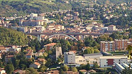
 View from the northwest | |
| Coordinates: 45°31′49″N 4°37′04″E / 45.5303°N 4.6178°E | |
| Country | France |
| Region | Auvergne-Rhône-Alpes |
| Department | Loire |
| Arrondissement | Saint-Étienne |
| Canton | Rive-de-Gier |
| Intercommunality | Saint-Étienne Métropole |
| Government | |
| • Mayor (2020–2026) | Vincent Bony[1] |
| Area 1 | 7.33 km2 (2.83 sq mi) |
| Population (2021)[2] | 15,214 |
| • Density | 2,100/km2 (5,400/sq mi) |
| Time zone | UTC+01:00 (CET) |
| • Summer (DST) | UTC+02:00 (CEST) |
| INSEE/Postal code | 42186 /42800 |
| Elevation | 227–394 m (745–1,293 ft) (avg. 260 m or 850 ft) |
| 1 French Land Register data, which excludes lakes, ponds, glaciers > 1 km2 (0.386 sq mi or 247 acres) and river estuaries. | |
Rive-de-Gier (French pronunciation: [ʁiv də ʒje], literally Bank of Gier; Arpitan: Vâr-de-Giér) is a commune in the Loire department in central France.
In 2020, with a population of 15,086 inhabitants and an area of 7.3 km², the population density is 2,058 inhabitants per km²
It was an important center of Loire coal mining basin, glass making and iron and steel manufacture in the 19th century. In the late 20th century the town lost most of its heavy industries.
- ^ "Répertoire national des élus: les maires" (in French). data.gouv.fr, Plateforme ouverte des données publiques françaises. 13 September 2022.
- ^ "Populations légales 2021" (in French). The National Institute of Statistics and Economic Studies. 28 December 2023.


