| Ant | |
|---|---|
 The river at How Hill | |
| Location | |
| Country | England |
| Region | Norfolk |
| Physical characteristics | |
| Source | |
| • location | Antingham |
| • coordinates | 52°51′03″N 1°21′12″E / 52.8507°N 1.3533°E |
| • elevation | 27 m (89 ft) |
| Mouth | River Bure |
• location | Ant Mouth, south of Ludham Bridge |
• coordinates | 52°41′23″N 1°30′47″E / 52.6896°N 1.5131°E |
• elevation | 0 m (0 ft) |
| Length | 27.3 km (17.0 mi) |
| Basin features | |
| River system | River Bure |
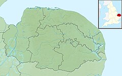
The River Ant is a tributary river of the River Bure in the county of Norfolk, England.[1] It is 27 kilometres (17 mi) long (of which 8.75 miles are now navigable), and has an overall drop of 27 metres from source to mouth. It is said that the Ant was formerly known as the River Smalea and that this is the origin of the name of the village of Smallburgh.[2] The modern name is a back-formation from Antingham.[3]
The Ant Broads & Marshes NNR is a national nature reserve.
- ^ Ordnance Survey (2005). OS Explorer Map OL40 - The Broads. ISBN 0-319-23769-9.
- ^ "History". Smallburgh Parish. Archived from the original on 8 April 2012.
- ^ Eilert Ekwall (1928). English River Names. OUP. p. 372.
